City of Vader
Climate Plan Subelement
-
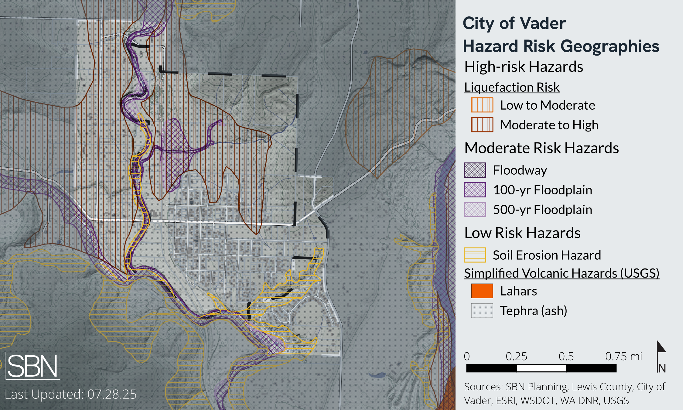
As a small rural community with a variety climate change hazards and planning implications. We documented current conditions, future risks, and opportunities to meet the state, regional, and county requirements.
-
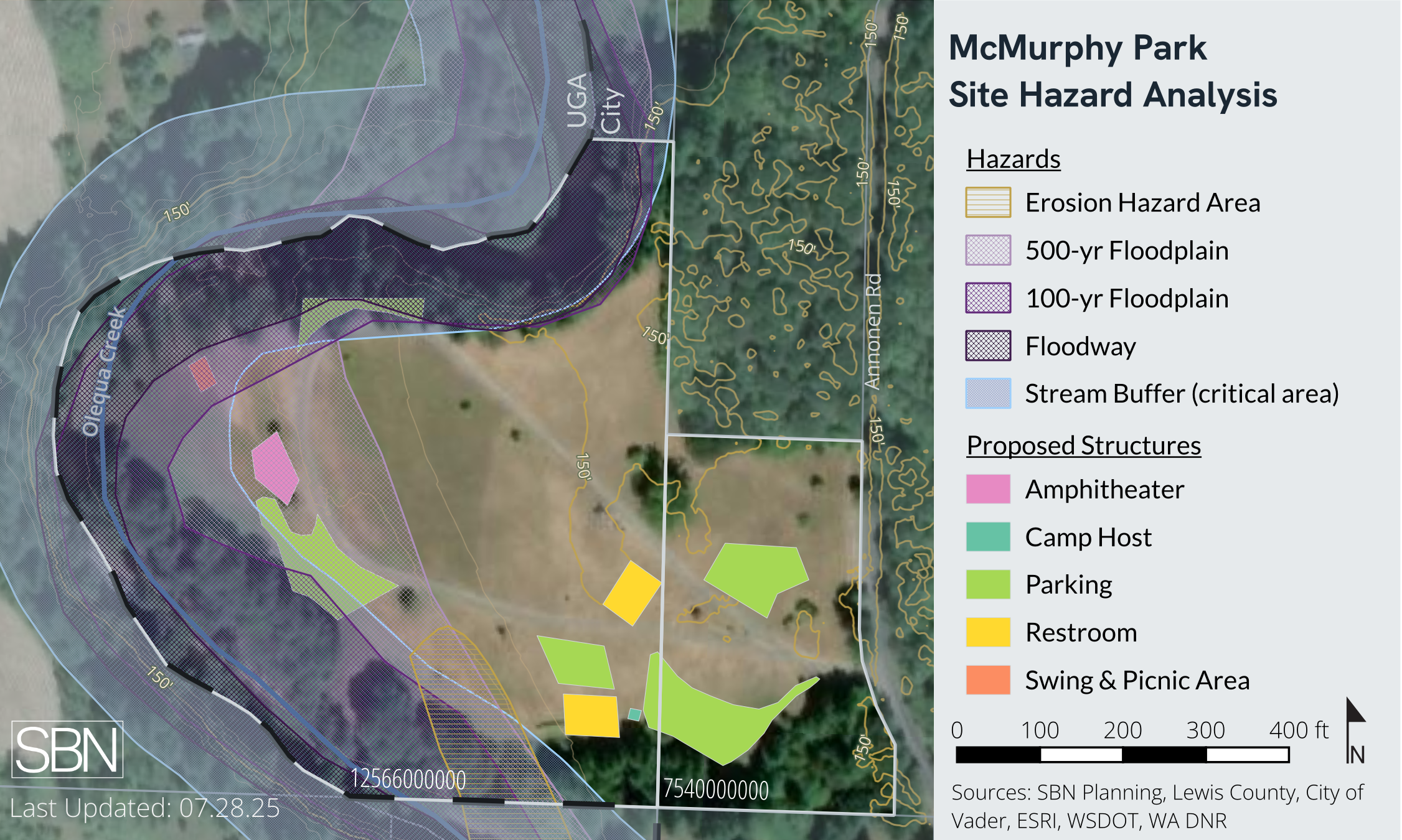
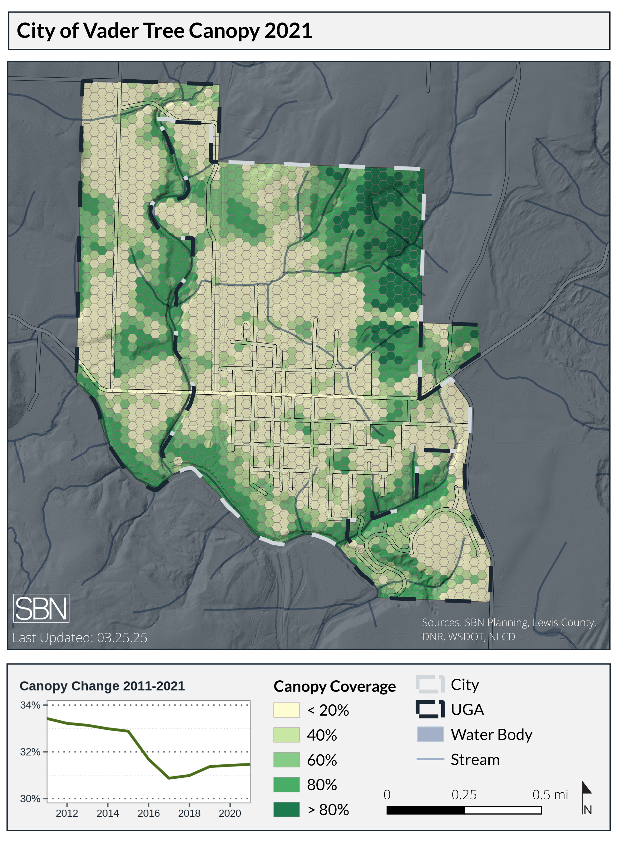
New maps documenting existing conditions, critical resources, and major hazards.
-
Drafting of new goals and policies addressing climate change and risks to the assets in the jurisdiction. Assessing existing plans and possible changes to address climate risks.
Related Projects: Vader Comprehensive Plan, Engagement Planning, GIS Services
As part of the 2025 Comprehensive Plan Update
SBN was brought in with less than a year remaining to update the comprehensive plan and meet the deliverable requirements for the Washington State Department of Commerce Climate Planning Grant. Our team took over the grant management, organized engagement, and created the new Climate Plan subelement of the Natural Resources chapter.
The Climate Planning subelement of Vader’s 2025 Comprehensive Plan Update included an analysis of natural hazards, public infrastructure at risk, and suggestions for implementing these findings in functional plans and City policies.
Services Provided
GIS Analysis
Existing Conditions Analysis
Grant and Budget Management
Public Engagement
Code and Regulatory Gap Analysis