City of Vader
Comprehensive Plan Update
-
Update housing and employment capacity, and integrate annexation capacity with county coordination through an ILA process.
-
Gap analysis of existing development regulations to comply with new state laws and regulatory requirements.
-
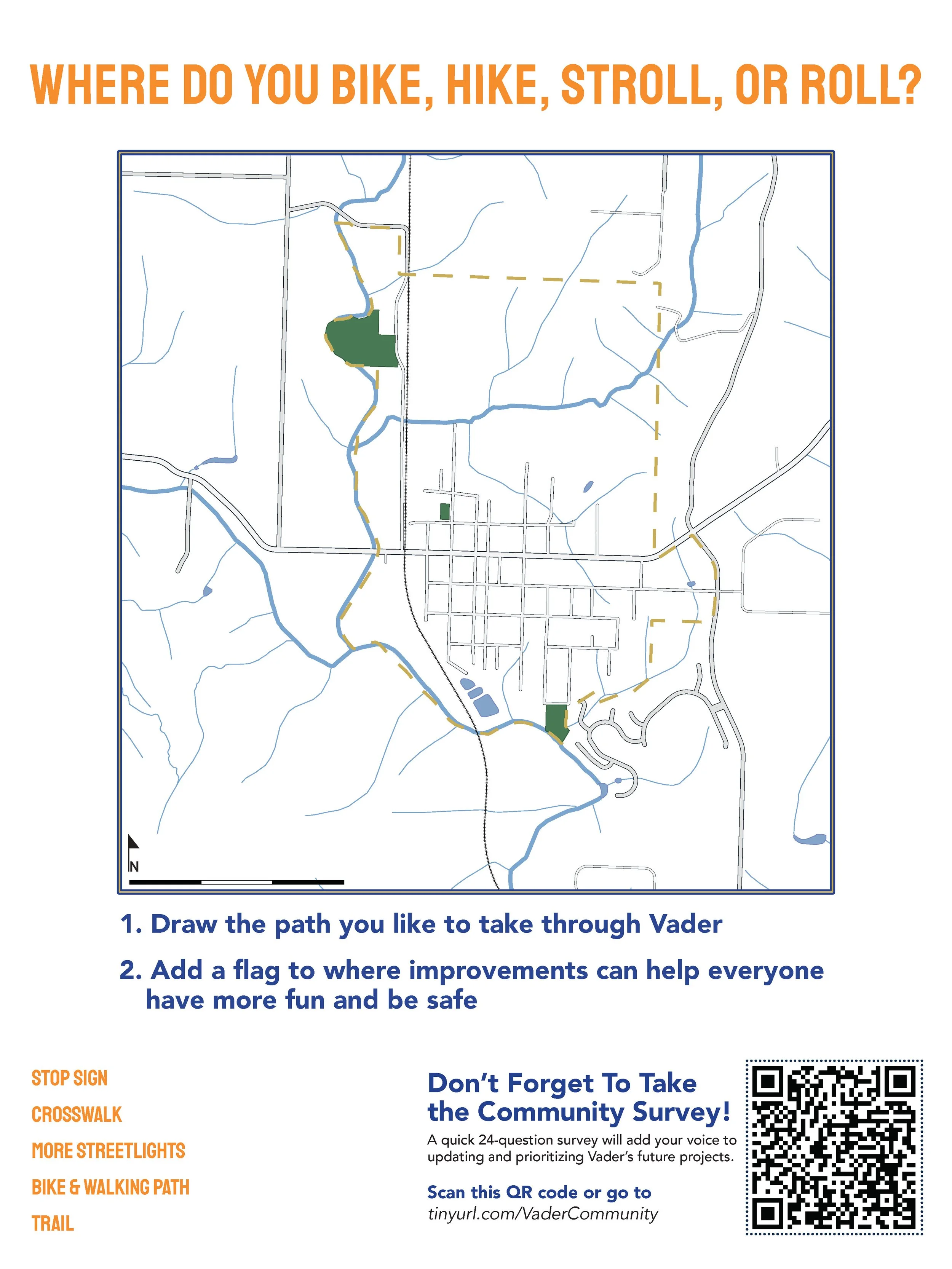
Administer community-wide survey, run public participation events, and create materials for public participation in various community events.
-
Coordinate timing, budgets, and continuity while updating multiple plans and annexing additional lands into the jurisdiction. Item description


2025 Update to Comprehensive Plan, New Climate Plan, PROS Plan Update, Development Regulations, and Annexation Project.
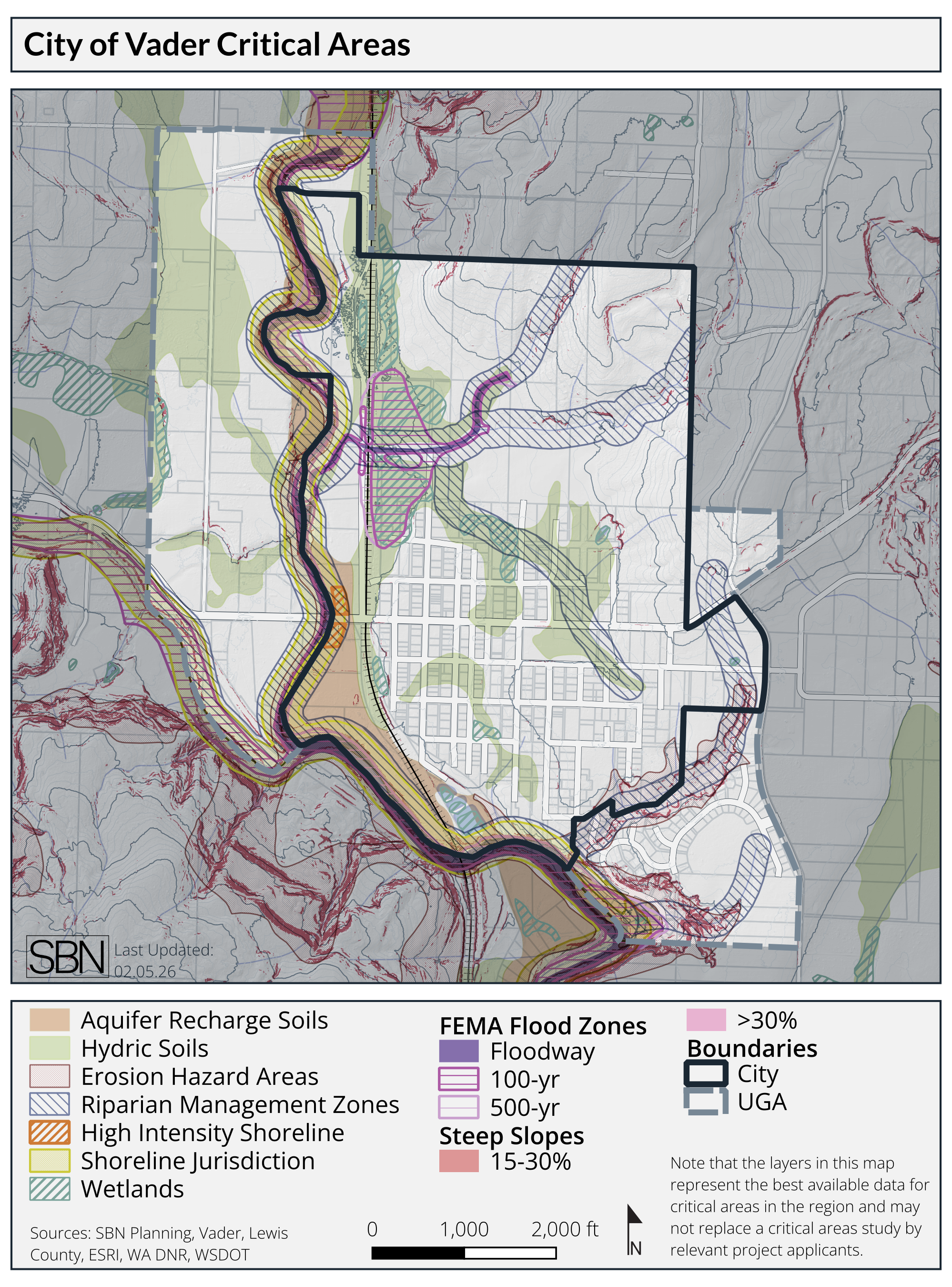
The City of Vader's comprehensive plan update requires the creation of a new comprehensive plan to comply with state, regional, and county requirements under the GMA. The full plan will be completed by the end of 2025.
In addition to managing the periodic update grant for the City as part of this update, our team is providing On-Call Planning Services to the jurisdiction.
Services Provided
Project Management: Lead coordination with multiple agencies and budget tracking for several contemporaneously moving projects.
Planning Coordination
Facilitation: Public meetings, packet material development, OPMA compliance, and events.
Land Capacity Analysis
Development Regulation Updates
Public Engagement
Multi-Project Integration
Grant and Budget Management